The College of Staten Island’s GeoSpatial Data Center supports and empowers faculty, staff, students, community-based organizations, government, and businesses, by making Geographic Information Systems (GIS) technology accessible to achieve innovative geospatial solutions.
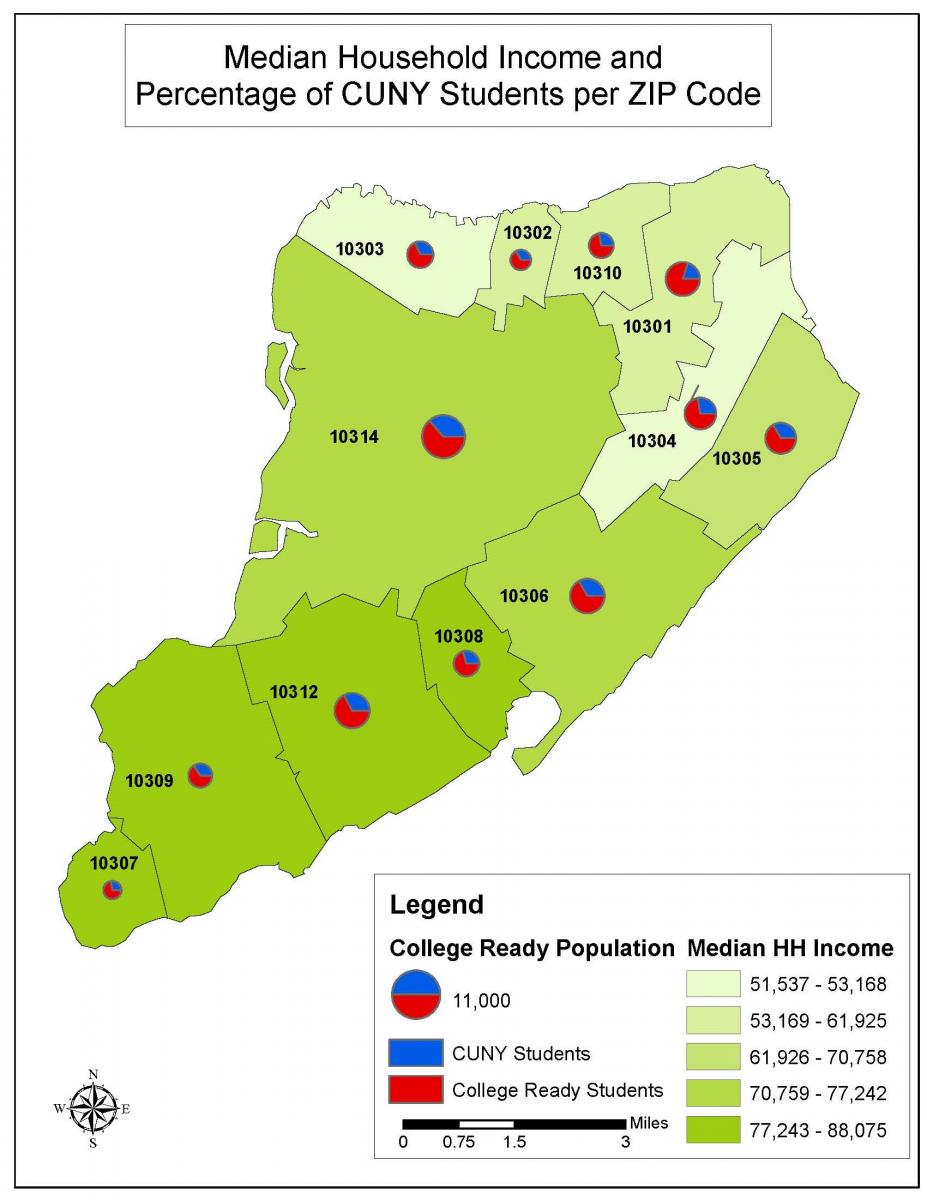
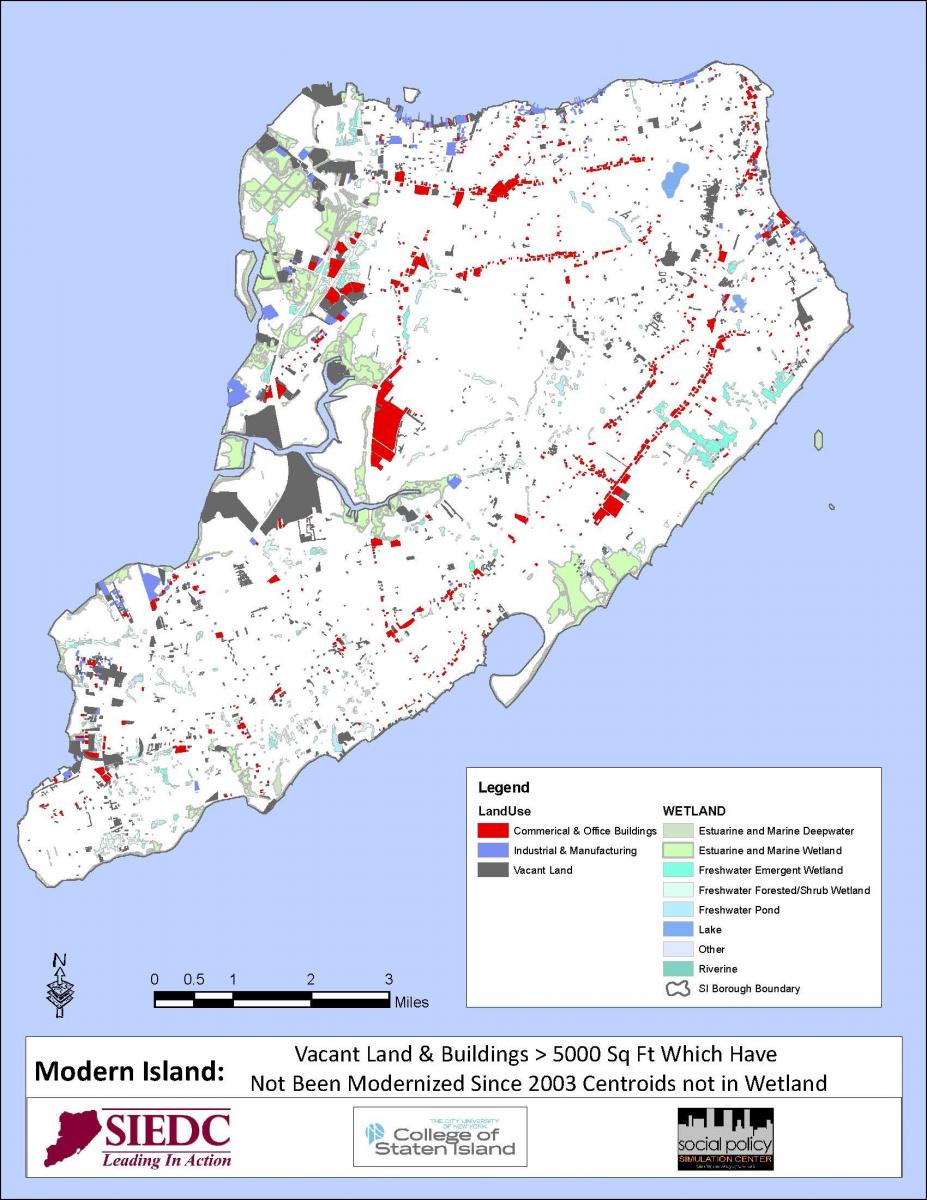
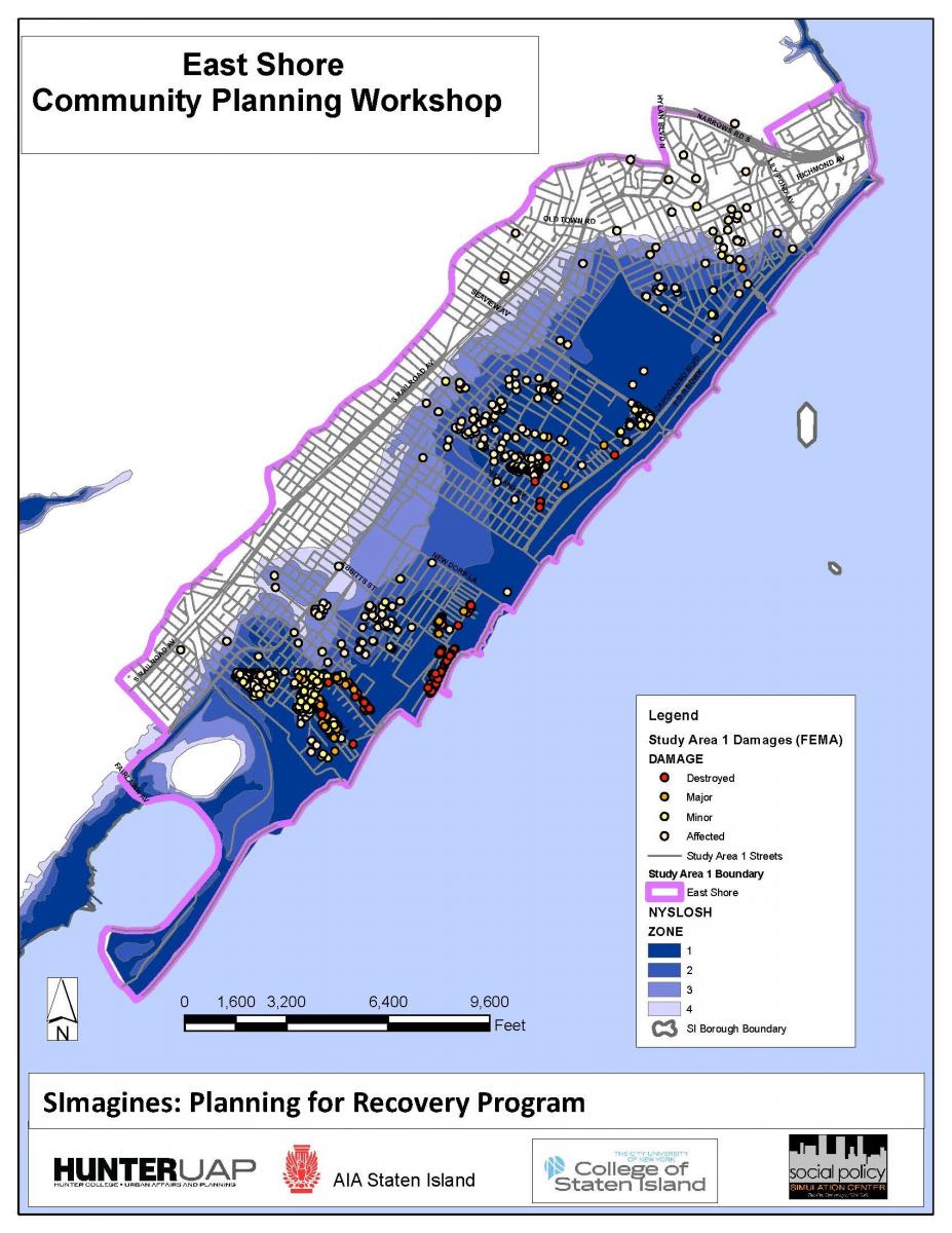
GIS allows us, in a wide variety of applications, to visualize, question, analyze, and interpret data to better understand relationships, patterns, and trends in form of maps, globes, reports, and charts.
Contact Information